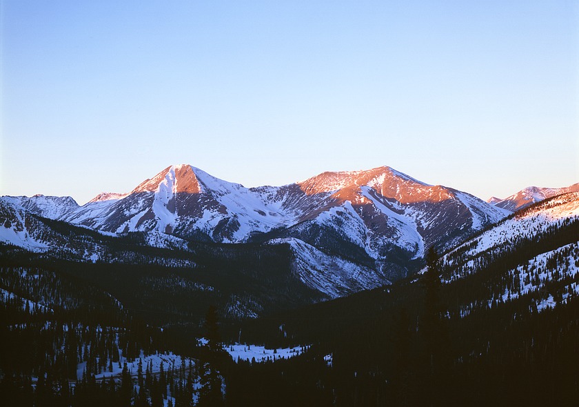

This is the view north from the highway over Monarch Pass. It was
taken at the end of January during an obviously lean snow year. In
fact, it was only a few days after the Challenger disaster in 1986.
Since January is our driest month, whatever snow falls as the jet
stream moves south from about October to December is about what we
have to last us until it moves back north starting about the middle
of February.
GPS location: 38° 29.9'N, 106° 19.6'W; 11,300 feet altitude.
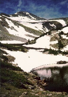 After admiring it many times when going over Monarch Pass, I had
climbed Mt. Aetna the previous summer from the other side shown
here, namely Hunky Dory Gulch -- yes, that's it's real name. It's
an untrailed route up through the timber to a nice, hidden alpine
lake not on the topo map (photo at right), and then up not-very-steep
tundra and (eventually) chiprock to the top.
After admiring it many times when going over Monarch Pass, I had
climbed Mt. Aetna the previous summer from the other side shown
here, namely Hunky Dory Gulch -- yes, that's it's real name. It's
an untrailed route up through the timber to a nice, hidden alpine
lake not on the topo map (photo at right), and then up not-very-steep
tundra and (eventually) chiprock to the top.
The aspect ratio of the photo shown is (exactly) 1.425. There are
some tighter crops (higher a.r.'s) with less sky that I like, but
this shows the full expanse of sky in the original.
The native resolution of the original digital file is extremely
high (84 MP). This 484 KP version for electronic display represents
a reduction in area of ~178x.
All copyrights reserved. © 2019 C. Wetherill.