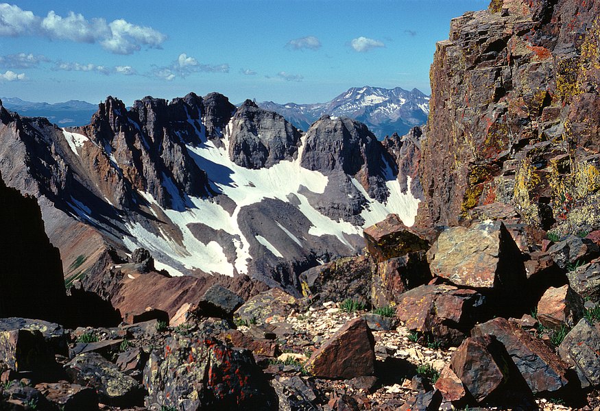


In the distance is (l->r) Mount Wilson, El Diente, and Gladstone Peak,
while to their left is the rock pinnacle Lizard Head (14 2/3 miles away).
At lower left the low point in the ridge is Blue Lakes Pass. Beyond it is
Gilpin Peak, just out of view to the left; to its right is the rugged ridge
(UN 13,543) connecting it with Dallas Peak, which is out of view to the right.
When I zoom way in, the lower (?) summit of UN 13,543, the one to the left,
appears to have either a cairn or some kind of natural rock "bump" on its top.
So maybe it had been climbed before this was taken.
At farthest left in the distance (under the bright cloud) is Silver
Mountain, N of Ophir and S-SE of the Telluride ski area.
GPS location: 38° 00.1'N, 107° 47¼'W; 13,500 feet altitude.
(pretty sure this was taken at "Scree Col")
The native resolution of the original digital file is high (7½ MP). This 500+ KP version for electronic display represents a reduction in area of ~15x.
This slide is strongly warped (due to being 40+ years old) and doesn't scan well from a focus point of view; parts of the image that are sharp on the slide look blurred here, upon close inspection, and other parts that are near the near depth of field are blurrier than in the slide. I've thought about a making a glass carrier for my scanner slide holder, to squish the film flat, but it both requires very thin glass (since two layers glass need to add up to about the thickness of a cardboard slide mount) and because it requires taking the slide out of its original Kodak mount -- always a delicate and risky operation that I prefer not doing, even with the DIY re-do mounts. The net effect as is is that this scan can't withstand a huge amount of enlargement.
It's also worth noting that the aspect ratio here is slightly different from a perfect 3:2, at 1.46.
All copyrights reserved. © 2018 C. Wetherill.

